What happens when you let your stomach lead the way to your Labor Day activities?
You eat breakfast at Ruth's Diner of course!
And then you search for a hike nearby in your trusty hiking book.
That's how we found ourselves at the top of Emigration Canyon hiking along the ridgeline.
The book said spring, fall or winter (snowshoeing) was the best time to hike and we figured it was close enough to fall.
We weren't disappointed!
We drove through the narrow canyon and stopped at the Little Mountain Summit parking area where we could look down into Little Dell Reservoir before our hike even began. We shared the road and the top view with plenty of bicyclists out for a Labor Day ride.
Little Mountain is also where the pioneers led by Brigham Young made their final descent into the Salt Lake Valley in 1847. Kind of cool to picture ourselves as pioneers walking along the paths and see what they saw.
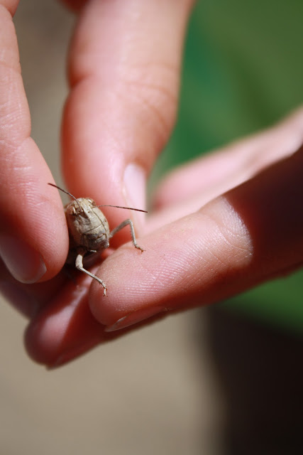
My book said we would share the trail with grasshoppers/crickets, lizards and rattlesnakes.
I was thankful we didn't see any snakes, but my boys were on the lookout for anything that moved.
Sharing grasshopper holds is important in families right?
 |
| Little Dell Reservoir |
Hills! What goes up, must come down right?
Elliott, Ollie and Adam ran up a few.
I wish I had that kind of stamina right now...
I'll be honest. The first hill I was thinking- what kind of hike is this?
The first hill wasn't very pretty and lots of uphills, but once we saw the big views- it was great.
Elliott, Ollie and Adam ran up a few.
I wish I had that kind of stamina right now...
I'll be honest. The first hill I was thinking- what kind of hike is this?
The first hill wasn't very pretty and lots of uphills, but once we saw the big views- it was great.
We all liked the downhills at the end better-
but nothing like getting to the top of a peak to see the view!
but nothing like getting to the top of a peak to see the view!
Indian Paintbrush
At the top of one peak.
Fall colors are out in early September.
Overlooking Parley's Canyon and I-80 on the South side.
Emigration Canyon and luxury homes in the background on the North.
on the ridgeline
Linc and I were the slow ones in the group, and happened upon this tiny lizard on the rocky trail!
Linc named him Rocky.
scrub oak
The trail we came on- behind the boys.
Linc investigating bugs- mostly grasshoppers.
The bit of shade we found to take a rest.
Thank goodness for the cool breeze we felt on the ridge the entire hike.
My book says this is a better hike in the spring, fall or even snowshoeing in the winter.
Summer is just too hot with no shade.
The cool breeze and changing leaves have me so excited for fall!
The cool breeze and changing leaves have me so excited for fall!
flower in the rocks
View of Little Dell Reservoir in Mountain Dell Canyon.
I just love these pictures of Little Linc exploring the big mountains.
the final descent
We all wanted to hike up a few more peaks, but Linc was getting tired and required lots of carrying, so we did what we could. This was an interesting hike with cool views.
I would love to go back for a snowshoe someday!
I would love to go back for a snowshoe someday!
Emigration Canyon Ridgeline
Directions:
On Sunnyside Avenue in Salt Lake, pass Hogle Zoo on the right and This Is The Place Heritage Park on the left. Continue another 8 miles up Emigration Canyon (passing Ruth's Diner) to the Little Mountain Summit parking area on the right.
To get to the trail, pass the restrooms and follow the faint trail to the west, passing a natural gas utility station on the left and communications towers on your right. Soon you come to a crumbling asphalt road that continues up the trail for about 100 yards before giving way to an old Jeep trail. Eventually the trail turns faint and becomes a single-track footpath that degrades into a game trail, and then no trail at all. You can stick to the ridge and follow the six successively higher hills in a southwest direction without getting lost.
The total hike round trip is 5.2 miles out and back, or however short you want to go.


